Showing posts with label road trip. Show all posts

Saturday, July 31, 2021

Should you visit the Skywalk at Grand Canyon West?

September is one of our favorite months to take a road trip. After touring Saguaro National Park in Tucson and playing golf in Scottsdale, Arizona, we headed to the Grand Canyon. Having visited the south rim several times, we chose a different destination this time—Grand CanyonWest. Of course, the big draw there was the see-through glass-bottomed Skywalk that extends out over the deep canyon.

Since the Skywalk is located on the Hualapai NationIndian Reservation, and there really are no large towns nearby, we chose to stay at Grand Canyon Western Ranch, only about 16 miles away, the night before our excursion.

Our drive from Scottsdale was very pleasant as we passed through the Sonoran Desert with scrub brush and the beginnings of hills, canyons, and valleys. We stopped along the way at Grapevine Mesa National Landmark and Joshua Tree Forest and took photos of mountains and a beautiful bluff before arriving at the Ranch.

The remotely located Ranch provided a simple cabin that overlooked the imposing bluff we had photographed earlier. A late afternoon walk, cowboy dinner, and singing around a campfire provided a somewhat “authentic” look at life in the desert.


The next morning we arrived early at the Skywalk, parked, and rode the shuttle to visitor areas. The first stop for the shuttle was at Hualapai Ranch, and old-time Western town with horse riding, zipline, gift shop and restaurant. We skipped this in order to get to the Skywalk before crowds came.


What an amazing structure this is! The ten-foot wide horseshoe-shaped walkway is constructed of three-inch thick plexiglass and lots of supporting steel. On this bridge you can look into the canyon 4,000 feet below to see the Colorado River, multi-colored strata, craggy precipices, and huge walls worn smooth by wind and water. It’s a geological marvel revealing millions of years of evolution.

We walked back and forth over the semi-circle taking in the marvelous views. I longed to have a camera, but visitors are not allowed to take anything onto the Skywalk. So we engaged the professional photographer to record this incredible experience. Looking down into the canyon provides a different perspective that we found insightful, although it might not be enjoyable for anyone afraid of heights.

Also at this site is a natural  photo-worthy formation resembling an eagle with spread wings that has been named Eagle Point. About noon we took the shuttle to Guano Point and hiked to the spot where a cave with bats was found years ago. A cable car was constructed to transport bat guano, which was used for fertilizer. After an Air Force jet damaged the cable car, it was never repaired.


We spent almost two hours walking along the canyon rim, soaking in excellent views of cliffs and river below. Rock formations in the area were simply made for climbing, so I scrambled to the top of one large formation while trying to follow an elusive trail. After descending at the other end, it took awhile to meet up with Larry again. He had been recording this geological history of the Earth as revealed in the rocks and cliffs with his camera.

While the Skywalk is worth doing because of its uniqueness, overall the Grand Canyon never ceases to amaze. It’s one of our favorite places because of the variety of scenery, changing colors throughout the day, the immensity of the canyon, and remembrances of our raft trip on the Colorado River below.

Photos by Larry and Beverly Burmeier


Thursday, January 14, 2021

Driving Colorado's San Juan Skyway

For a spectacular spring or summer drive, map your course on the 233-mile (a little more with detours) San Juan Skyway in Colorado. This road trip will take you around half of the largest mountain range in Colorado.

Wildflower meadows surrounded by majestic mountains.

The loop can be driven in less than seven hours, but plan at least a long weekend to enjoy all the sights and activities along this famous highway. Take time to explore abandoned mining sites, scenic trails for hiking or biking, jeep tours over mountain passes and through wildflower meadows, natural hot springs perfect for soaking in glorious views, and Old West towns along the way.

Jeep ride to mountain pass from Silverton

Journey overview

Start your tour in Durango, stop at Silverton (48 miles by car), then head to Ouray (23 miles), Ridgway (another 10.5 miles), and on to Telluride (39 miles) or nearby Mountain Village, which is exquisite in summer. Continue on the western portion of the San Juan Skyway to Cortez (75 miles) and then return to Durango (46 miles).

Durango

Fish, float, or raft on the Animas River which runs through Durango.

Durango is well-known as the starting point for the historic Silverton Narrow Gauge Railroad. But with the free-flowing Animas River running through town and the rugged San Juan Mountains in view, it has become a gateway for outdoor activities in southwestern Colorado. In addition to the beauty of its natural setting, Durango’s Old West history and Southwest-inspired shopping and cuisine make it a top travel destination.
Stay at or visit the renowned Strater Hotel in Durango.

the haunted 19th century Strater Hotel, a prominent landmark in downtown, or at least take a tour. For a special treat, feast on a sumptuous breakfast at The Rochester Hotel and Leland House. Take a jeep tour into the mountains, play golf on a hillside, ride the train, or tube in the Animas River. 

 Ouray

Take the train or drive to Silverton, an Old West mining town.

Drive to Silverton, where you’ll think the time machine has zapped you back a century. Then continue to Ouray via the Million Dollar Highway (U.S. 550), a scenic mountainous stretch of hairpin curves.

The Million Dollar Highway is a spectacular drive.

Although it’s only 25 miles from Silverton to Ouray, this road, which was rebuilt in the early 1920s at considerable cost (hence the name), requires navigating narrow lanes on the edge of steep cliffs. Allow time to gasp at the crimson mountains of Red Mountain Pass as you navigate this breathtaking road.

Waterfall in Box Canyon
at Ouray

Called “Switzerland of America,” Ouray is the perfect base camp for exploring peaks and valleys of the San Juan Mountains, as well as remnants of mining towns,  by jeep, bike, or on foot. Fish or raft in the Uncompahgre River. Dip into the soothing hot springs, watch a glassblower at work, and marvel at the waterfall in Box Canyon.

Telluride

In addition to summer festivals, 
Telluride's red rock landscape is
fun to hike--this one to a waterfall.

A famous ski resort in winter, Telluride becomes a city of festivals in summer—bluegrass music, yoga, arts, and mountain biking. Stay in town to be close to activities and shopping. The entire town has been designated a National Historic Landmark District with all construction promoting its Victorian image.

Alternately, stay at beautiful Mountain Village, just a free gondola ride up the mountain, where panoramas viewed from 9,500 feet include magnificent peaks of the San Juan Mountains and plenty of outdoor adventure for all skill levels.

A free gondola take visitors between Telluride and Mountain Village.


Mesa Verde

Spend a day at Mesa Verde National Park for an historic look at how the Anasazi tribes lived and worked long before “civilization” came to this part of the country. Explore the cliff dwellings to learn about ancestral life in one of the most preserved archeological sites.

Mesa Verde National Park features Anasazi ruins.

For a less crowded look, check out Ute Mountain Tribal Park near Cortez, only open to the public with Ute guides navigating visitors into the wilderness adjacent to Mesa Verde's southern boundary. With only 1,300 visitors per year, Ute Mountain is a quiet spot where you can hike narrow trails and climb steep ladders onto high ledges.

Hieroglyphics are visible at Ute Mountain Tribal Park.

Complete the loop by returning to Durango. Follow up with activities you might have missed the first time here, or just savor your memories of this spectacular journey.

Try a game of golf when you return to Durango.
TIPS:                                      

  • The byway passes through five million acres of both the San Juan and Uncompahgre National Forests.
  • Recreational activities are also available along the Byway at Mancos State Park and Ridgway State Park.
  • For more information: www.coloradodirectory.com/maps/skyway.html

This article originally appeared in Dallas Morning News.

Photos by Larry and Beverly Burmeier

Tuesday, October 8, 2019

Drive roads less taken in Arizona and New Mexico


If you’re the kind of traveler who avoids Interstate freeways in favor of back road adventures, here’s a book you’ll enjoy reading. Arizona and New Mexico: 25 Scenic Side Trips (Imbrifex Books) by Rick Quinn will guide you through these two states that are full of stunning scenery and interesting landmarks on the roads less traveled.

And there's no better way to scratch the travel itch these days than by taking a road trip in your own car. 
When researching this book for the Roadtrip America series, Quinn drove 11,000 miles and shot 7,000 photographs. The result is expert advice that will help make a road trip through this part of the American southwest a memorable journey, perhaps the best summer vacation for your family.

Memorable is easy, since the region is loaded with natural wonders (Grand Canyon National Park, Carlsbad Caverns National Park, White Sands national Monument, Antelope Canyon, etc.), historical and cultural sites (Cliff Dwellings, Petroglyph National Monument, Aztec Ruins National Monument, etc.), and scenic landscapes (Enchanted Circle Scenic Byway, Monument Valley, Salt Mission Trail Scenic Byway, etc.).
Although Arizona and New Mexico are full of amazing and notable destinations like these, Quinn's desire is to entice travelers to explore more.

Of course he knows that the fastest way to travel long distances by car in the U.S. is on Interstate highways, so each side trip that he describes begins at an exit off an Interstate and takes the traveler back to an Interstate at the end.
Quinn provides alternative scenic routes from Interstates 10, 17, 40, and 25.  Each of the 25 trips is driveable in a day, so there’s no reason to stick with a boring, quick, point-A-to-point-B drive through. Choose as many detours as time allows for fascinating additions to your road journey.

The book is easy to follow with color-coded pages for routes that are sorted by geographic region. In addition to beautiful color photos, he includes visitor information for parks, attractions, and unusual lodging and dining along the way. A driver who sticks to Interstate travel might never see or even know about many of these. So it becomes a trip of discovery perfect for solo travelers or families looking to get away after months of quarantine--but hoping to avoid crowded cities, beaches, or other popular tourist destination.
A stunning landscape of deserts, mountains, and canyons provides a backdrop for explorations as you travel at a slower pace on recommended two-lane highways. Keep a highlighter handy as you read the book to mark the spots you won’t want to miss. Then plan your road trip through these remarkable Southwestern states.

The book is available from Amazon and other sources.

Thursday, July 6, 2017

Guidebook for Route 66, America's famous roadway


On a trip to Peru, we met a couple whose dream trip in America was to drive along Route 66. This iconic highway has a reputation in song and literature that has expanded beyond the borders of the country in which it is located. 

The myths and mysteries of this legendary highway are covered in great detail in Drew Knowles’ updated fifth edition of Route 66 Adventure Handbook (Santa Monica Press/ May 2017). If you’ve ever thought of traveling on the “Mother Road” of America, this is the one book to keep handy on your road trip. For Knowles, the journey becomes the destination—stopping along the way is as important as reaching a specific point.

The quirky side trips on Route 66 appeal to a new kind of traveler, the “heritage tourist,” people more interested in exploring the roots of America than overcrowded theme parks or bustling city attractions. For these tourists Knowles covers offbeat roadside attractions, vintage motels and cafes, unique museums, Art Deco architecture, and amazing natural wonders on this vintage road. 
Opened in 1926, Route 66 was almost discarded when cars started zipping along super highways and interstate freeways that bypassed its treasures. But a renewed interest in the cultural and social history represented along its byways began in the 1990s, and the route is once again a highlight of many tourists, both domestic and foreign.

Knowles starts off telling how Route 66 came to be and then suggests ways to get the most from your journey along the highway. Recognizing that businesses and attractions are continually changing, he admonishes travelers to keep an open mind and a wandering spirit. Just let yourself discover whatever comes along at each turn in the road.
How long will it take to drive the entire route of 2,451 miles? You could spend two weeks driving around 200-300 miles a day, but that would only allow time to visit the most popular sites and main cities. Better to plan a month-long road trip to allow for a more authentic experience visiting historic downtowns of scattered communities, stopping for a burger and root beer at a local soda shop, perusing antique shops, and spending a few nights in original 1950s motels.

Maps, navigational guidance, GPS coordinates, and plentiful photos will help you plan your trip and find specific points of interest. The book is divided into sections for each state through which Route 66 passes: Illinois, Missouri, Kansas, Oklahoma, Texas, New Mexico, Arizona, and California. If you can’t make the entire drive, you can easily plot your path through the states and along the paths of Route 66 that are most appealing.
At each way point, Knowles provides detailed information about far more attractions than one road trip can cover. So, even if you make a comprehensive plan, allow for unexpected diversions that are sure to happen when you travel deliberately, meander purposefully, and take time to visit with people as well as places. After all, that’s what a journey on Route 66 is all about.

Photos from free sources

Thursday, May 19, 2016

Traveling back roads? What to do if your car breaks down

Are you planning a road trip this summer? Even if you have your vehicle checked out thoroughly for any mechanical problems prior to leaving (really, a must), you should also be prepared in case you happen to get stranded on a lonely stretch of road with little or no cell phone service.

Especially if you like to venture off main highways and explore out-of-the-way roads and tiny towns, you should carry a paper road map to help locate where you are. Smartphones are wonderful for giving directions from one place to another or finding gas stations, tow trucks, or car dealerships in case of trouble. But your phone might not work as well as you need if you’re traveling on an isolated country road.
Driving the open road is fun--until trouble hits.
A red hazard warning triangle will alert other motorists if you have pulled to the side of the road, or if you can’t get the car off the road. In addition, or if you don’t have one of these, be sure to put your blinking emergency lights on. This makes your car more visible and will alert passing vehicles to the fact your car is not moving and that you might need assistance.
Hazard lights serve as warnings.

You can also hang a white cloth or piece of paper from the driver’s side window, scribble a sign to put in the rear window,  or tie a cloth on your car’s antenna as a signal for help. If you get out of the car to check on the problem, be sure not to stand or work on the car near the traffic side.

After dark, put on the interior light to signal the need for help. If the car’s engine will still run, turn it on periodically so you don’t run the battery down. If you get out of the car to flag down help, don’t block the hazard lights or stand in the path of oncoming traffic.
Should you stay with the car or seek help? The safest thing is stay with the car unless you recently passed something (a building, for example) where you might find assistance. If you’re certain help is within a reasonable walking distance, pull off the road and put a warning system into effect before leaving the vehicle.

Your main objective when stranded on the road is to remain visible while signaling your need for assistance. Even in the middle of nowhere, it’s possible either a stalled car or a driver wandering on the road may become victims of an accident because other drivers do not see them in time and realize their plight.
Photos from free sources.


Saturday, October 24, 2015

Drive the Blue Ridge Parkway in Virginia

On a recent trip, we discovered the beautiful RoanokeValley in the Blue Ridge Mountain region of Virginia. The city of Roanoke is the largest metropolitan area along the Blue Ridge Parkway, but there are plenty of small towns to visit with wonderfully friendly people.

View of Abbott Lake at Peaks of Otter Lodge
Although we  checked out several counties over four days, we didn’t cover the entire Blue Ridge Parkway. I’d love to come back and explore the full 469 miles of picturesque scenery that runs through Virginia and North Carolina. This thin ribbon of road on the ridge of mountains that are older than the Alps or Himalayas connects two national parks--Shennandoah and Great Smokey Mountains.

Mountain reflections in Abbott Lake.

With a 40 mph speed limit, the Parkway is designed for leisure travel. To really enjoy the views, visitors should take their time and schedule numerous side trips on foot, horseback, or bicycle or by boat. That's the best way to understand why the Blue Ridge Parkway is called America's Favorite Journey.
Hike and Bike

One of the bridges on the Roaring Run hike
Opportunities are plentiful for breaks on your road trip. Explore, discover, and renew your spirit on trails, at overlooks, and also  at concerts. Hike through serene natural areas and learn about historic sites. Trails vary from short jaunts that are great for stretching your legs to longer excursions in the mountains. Well-known trails include Peaks of Otter, Rocky Knob, Humpback Rocks, and along the James River.  At Roaring Run, a six-tenths mile trail featuring scenic bridges, overlooks, and a waterfall, an old historic furnace is the focal point.
Learn about coal mining at the
historic furnace at Roaring Run.
Bicyclists have a little more difficulty as elevation ranges from 649 to 6,047 feet, and there are no dedicated bike lanes on the Parkway. But, if riding is your thing, the Blue Ridge Mountains in southwest Virginia provide some of the best mountain biking on the East Coast.

Parks like New River Trail State Park, which runs parallel to the New River for 39 miles, offer excellent biking trails. Virginia’s Explore Park, at milepost 115 on the Blue Ridge Parkway, just east of Roanoke, offers terrain for bike riders of all skill levels.
Get on the water

Despite its name, New River is reputed to be the oldest river in North America. It’s designated as an American Heritage River, and small boats can easily navigate its class 1-3 rapids. The James and Roanoke Rivers are also suitable for paddling by canoe or kayak.
Spend a day swimming or boating at Smith Mountain Lake, the “Jewel of the Blue Ridge Mountains.” Located in a state park in Franklin County, it is the second largest and most popular freshwater lake in Virginia.


Smith Mountain Lake is a prime place for all kinds of
water fun--swimming, fishing, house boating, sailing, and more.
 
Tackle the Appalachian Trail
More than one-fourth of the Appalachian Trail lies in Virginia. The AT roughly parallels the Parkway from mile 0 at Rockfish Gap to mile 103 and can be accessed from numerous locations in the Blue Ridge region. If you choose to hike the AT for a few hours or for weeks, you’ll enjoy some breathtaking views.

One of the most photographed spots on the AT is McAfee Knob with excellent views of Catawba Valley. It’s easily accessible just west of Roanoke on Rt. 311 and will take a couple of hours to complete round trip.
Stay awhile
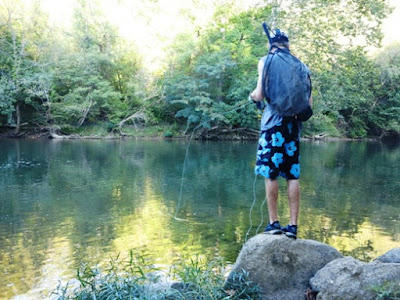
Fishing is a popular activity at rivers along the Blue Ridge Parkway.
Horseback riding, farmers' markets, and music concerts are other attractions.
The Roanoke Valley offers a variety of lodging choices for every budget including historic hotels, luxury waterfront suites and cottages, small hotels, and camping spots. Stay at one place and take day trips, or drive along the Parkway each day, stopping for various activities along the way (That’s what I’d like to do).

During our mid-September visit, leaves were just hinting of color, so I think October would be a perfect time to return. Cool temperatures, trees splashed with brilliant fall foliage, and great hiking weather would make this a memorable drive.

To help plan your trip, get the official publication of the Blue Ridge Parkway Association, which includes suggestions of places to pause or stay and their milepost locations.
Photos by Larry and Beverly Burmeier